Low: Loosing my High Sierra Photos (mile 558 to 903)
In case you were wondering why you haven't seen any of the photos of Sequoia, Kings Canyon and the rest of the 200 mile roadless stretch through the high Sierras the title pretty much says it all. Despite some valiant efforts by my friend Emma to recover them by consulting with some of the finest data recovery experts around, we discovered the memory chip in the SD card had cracked (probably in the mail), and they are gone.
I am extremely bummed but there is nothing I can do now. I've taken away two lessons from this. First, this is maybe some way of God telling me I need to leave photographing the Sierras to the professionals with cameras that can actually do more justice to this beautiful landscape. Second, the Sierras are meant to be enjoyed in person not on photopaper or on a computer screen, which will give me all the more reason to return for many more summer adventures in the high Sierras.
High: Cliffside Camping (mile 1,011)
On the 4th of July, I may not have had any fireworks but I had a show that beats any 4th of July festival I have ever been to. I was hiking with two new hikers I met in Yosemite, Smiles and Mad Dog Murphy, and we had just finished a long buggy section just after Yosemite and had been hopping up and down vallies for days down in the trees. Then we saw on the map this high ridge and were excited to camp out up there where no bugs could possible live. We climbed up and up this long stretch, and Mad Dog and I tried cutting up this side trail along a steep mountain side and quickly realized it would have been much better to stick to the forest service road. Up at the top the wind was whipping across but we had probably one of the best views I've seen on the PCT. We could look down these sharp cliffs to see Leavitt Lake (a beautiful crater lake) on one side and sprawling vallies on the other. Up top there was this amazing lichen that colored the rocks neon orange and green which was really cool against the black rock. Then the sunset came and lit up the sky with so many beautiful colors. I decided to lay out my sleeping bag just a few feet from the edge and was a little concerned all night that if I rolled over I'd fall right off. I also had to weigh all my gear down to make sure it didn't blow off the cliff. While it was one of the colder nights sleep, it was so worth it just lying in bed getting to watch both the sunset and sunrise in one of the most awesome lookouts!

High: My Vacation within a Vacation (mile 1,095)
One of my best breaks I've had yet on this trip came in early July when my mom decided to have a little California vacation of her own and came to visit me right as I reached South Lake Tahoe. After some minor communications troubles she finally found me dirty, tired, smelly, hungry, and terribly skinny with a big smile on my face waiting for her where the trail nears Tahoe at Echo Lake. We got right to work fixing me up heading to the hotel to shower, laundry to clean my clothes, the pharmacy to tend to my blisters, and KFC where I ordered this entire chocolate cake along with some tasty chicken. It was also great to get to sleep in a bed without mosquitoes buzzing in my ear, and this would be an unprecedented two full zero days which is quite rare seeing how most of my nights in town are just two nearos. My mom came all the way out here so I wanted to see her, and I could really use the break. I thought about it and since I started the trail I had only slept in a bed 4 of the nights and this would be 3 nights in a row. What a treat!My first day off I was given two orders by my mom; no walking and I must be eating constantly. We did some errands for me then went to tour Lake Tahoe a bit which was great because the PCT actually never gets too close to this beautiful lake. We drove over to Emerald Bay and got to pass along a ridge where the road had cliffs on either side and no guard rails which I thought was a bit ridiculous because if they don't need guard rails here then there shouldn't be any in the whole state of Ohio. I was able to trick my mom into walking down to a beach which turned out to be a huge drop down so I got my hiking fix for the day even if I was in hiking rehab. Down at the bottom was a sunny little beach and this beautiful historic summer home build with Scandinavian-style architecture and orate wood carvings all over. While we enjoyed the beach we also rented kayaks and paddled over to the only island in all of Lake Tahoe with the remains of an old tea hut perched upon the rocky peak. It felt great in the kayak being able to move without having to use my legs. Then later we went to one of the casino buffets across the state line in Nevada. It was just what I needed with lots of prime rib and sushi but sadly on the trail my stomach had shrunken and was not used to big meals like this. I think I way finishing my 4th plate getting ready to eye up the desserts when I hit capacity and felt like my belly was bursting at the seams. It wasn't that nice full feeling either but was just painful to the point that all I wanted to do way lay down. Sadly we left with no room for me to shove any of the tasty dessert into my belly.
The next day I did a much better job being lazy and staying put. Mom was very excited to offer hikers rides up to the trailhead and we crammed in three more hikers in on our way back into town. I was able to resupply for some the small towns ahead and was so excited to hit up the bargain grocery outlet where they had $2 pints of Ben and Jerry's and I bought 15 days worth of food for just $115. I spent the afternoon sitting in the sun doing puzzles by the pool and having a great time with my mom. We saw an awesome sunset over Lake Tahoe and grabbed some tasty burgers from a nice restaurant that kept the grill going for us. It was hard getting back into thru-hiker mode after luxuries like that, but I owe my mom big time for coming out to visit and trying to fix me up for the second half of my journey.


Low: Orientation Fail x3 (mile 1,102, 1,159 and 1,162)
For someone who always has his head buried in his maps planning out his route for the rest of the day I didn't think I'd be getting lost on the trail very often. However, that was not the case for the section between Echo Lake and Sierra City. My first blunder was right out on the first day by the beautiful Aloha Lake reservoir. This section in the Desolation Wilderness was so well signed but was covered with other trails besides the PCT. For a while the PCT was heading in the direction of Mosquito Pass on the far end of Aloha Lake so I figured the PCT just went over that pass as well. I hiked over the pass and down to the next lake before I realized I had missed a turn about 1.5 miles back which was not a fun backtract, but at least the bugs weren't as bad in that section as the name suggested.The next two blunders I think were some bad luck that passed over from Friday the 13, on Saturday the 14 just after I had crossed I-80. I had read in the guidebook that after you cross the interstate you shouldn't take the side trail to the left to get to this rest area and instead should stay on the PCT which also goes right near the rest area. At the trail junction, I unfortunately didn't see that side trail and mistook the PCT for the side trail so headed up a different trail until I started thinking I should be there by not then looked at my shadow and realized I was heading east which was wrong and turned around. The actual PCT took my right to the rest area which sadly did not have any trail magic or even a pop or vending machine for me to snack on either.
The final mistake was the worst because I managed to confuse two of my fellow hikers, Carpenter and Creeper, as well. We had just climbed up to Castle Pass and were excited to reach this cool Sierra Club ski hut. There was another 4 way intersection, and the map made it look like we were supposed to head up. I saw Carpenter take the trail straight ahead which was sloping down and told him we should go up to the left instead. The trail I suggested took us up this extremely steep ridgeline climb. It did have some gorgeous views, but after a while, I saw Carpenter had stopped and had his hands out like he was ready to strangle me. He pointed way down to this meadow where the hut was supposed to be, and I had led us up a steep ridge the wrong way yet again. I felt so guilty and terrible and when I got back down to the pass I made a big PCT arrow to make sure none of the hikers behind me made the same error. I hope I have no more bad sections like this.

Low: Slipping on Snow in a No Snow Year (mile 1,149)
As I have mentioned before, this year was an extremely low snow year in the Sierras after one of the worst years recorded in 2011. I didn't meet any hikers carrying an ice axe with them or crampons to help get across the snow fields I'd usually would expect to find in the high passes. When I was in the high Sierras, I could only recall walking over tiny patches of snow on the trail no more than 20 ft across coming down Forester and Glen Pass (and Muir pass where I lost the trail and headed for the wrong pass having to correct myself across a few snow fields). Even on those small patches, I did get a sense of how scary snow can be when it is super icy and my feet can't dig in to get a good grip. I also could imagine how frustrating it would be when I take a step to find the snow give out under me and then be buried up to my knee (this is what hikers refer to as "postholing" when this happens step after step).Well, turned out, there was one more tiny patch of snow waiting for me just on the side of a mountain heading down to Donner Pass. This patch couldn't have been more than 30 ft across the trail, but was at a steeper angle falling about 20 ft down to more gravely rock below. I saw some people had just walked down to the bottom to cross along the rocks to avoid the snow, but this was such a rare occurrence, I wanted to go for it. I got up on the snow to find it was still quite icy despite it being late afternoon (when snow is usually softer form melting in the afternoon and I'd normally worry about postholing). As I slowly made my way across, I went to plant my one foot then slipped and started to slide down the snow. I immediately started to claw at the snow digging my hands until I slowed myself to a stop and stabilized myself trying to find new place to to dig into so I could stand back up. I had to find a way to make it back up the 5 to 8 feet I slid down to retrieve my pole and was extra careful where I placed my feet. The poles made things easier but when I finally got to the end I realized there was another steep 4 ft drop down the snow to get back on the trail which I wasn't about to attempt. Only then did I look up to see the trail of footprints where other hikers had crossed the snowpatch, and I headed up to those to finally make it safely to the trail descending down the rocks at the end of the snowpatch. I could only laugh at myself for almost having a snow-related injury on a year with the least snow in decades. I also walked away with a profound respect for the snow conditions, and when I do ever get the chance to hike in the bigger snow fields later in life, I will be much more cautious. It also proved to me the need for an ice axe in the higher snow years because I know if I had started to slide like that in the morning the snow would have been too icy for me to be able to stop myself on my own. Regardless, I'm glad I made it safely through all the snow in the Sierras without getting injured, even if it was less than 100 ft of the 500+ miles through central California.
High: Gourmet Eats (mile 1,198, 1,290)
I feel like in July I finally started to eat better both on trail and off. In the backcountry I have uped both the quantity and quality of my food getting rid of some of the items I can't stand (I don't think I will ever eat tuna fish again) and finding new ones both myself and from other hiker's diets (like brownie mix and ProBars). At the same time I have been treating myself to some scrumptious meals in the small northern California towns. One of the best were the BBQ ribs I had at the Red Moose Inn in Sierra City. Bill and Margaret Price are two phenomenal trail angels who let hikers camp out behind their inn and restaurant. Each day they cook up awesome ribs mostly just for us thru-hikers. All afternoon I got to smell the wonderful seasoning, and at dinner, they were just as delicious. The best was when Margaret came by with a plate of seconds for everyone, what a treat!
High: Eventful Swimming Holes (mile 1,250, 1,429)
I think my favorite thing about northern California is that there actually are creeks big enough to swim in unlike Southern California, and it doesn't come straight off the snow fields making it freezing cold like Central California. I've had quite a few opportunities to take a dip and cool off which is always a great break. Not only could I cool off and play in the water but I could also scrub the dirt off your legs and wear my clothes in for some makeshift laundry which will make worlds of a difference. I've also found that some of the swimming holes have a bit more to offer as well.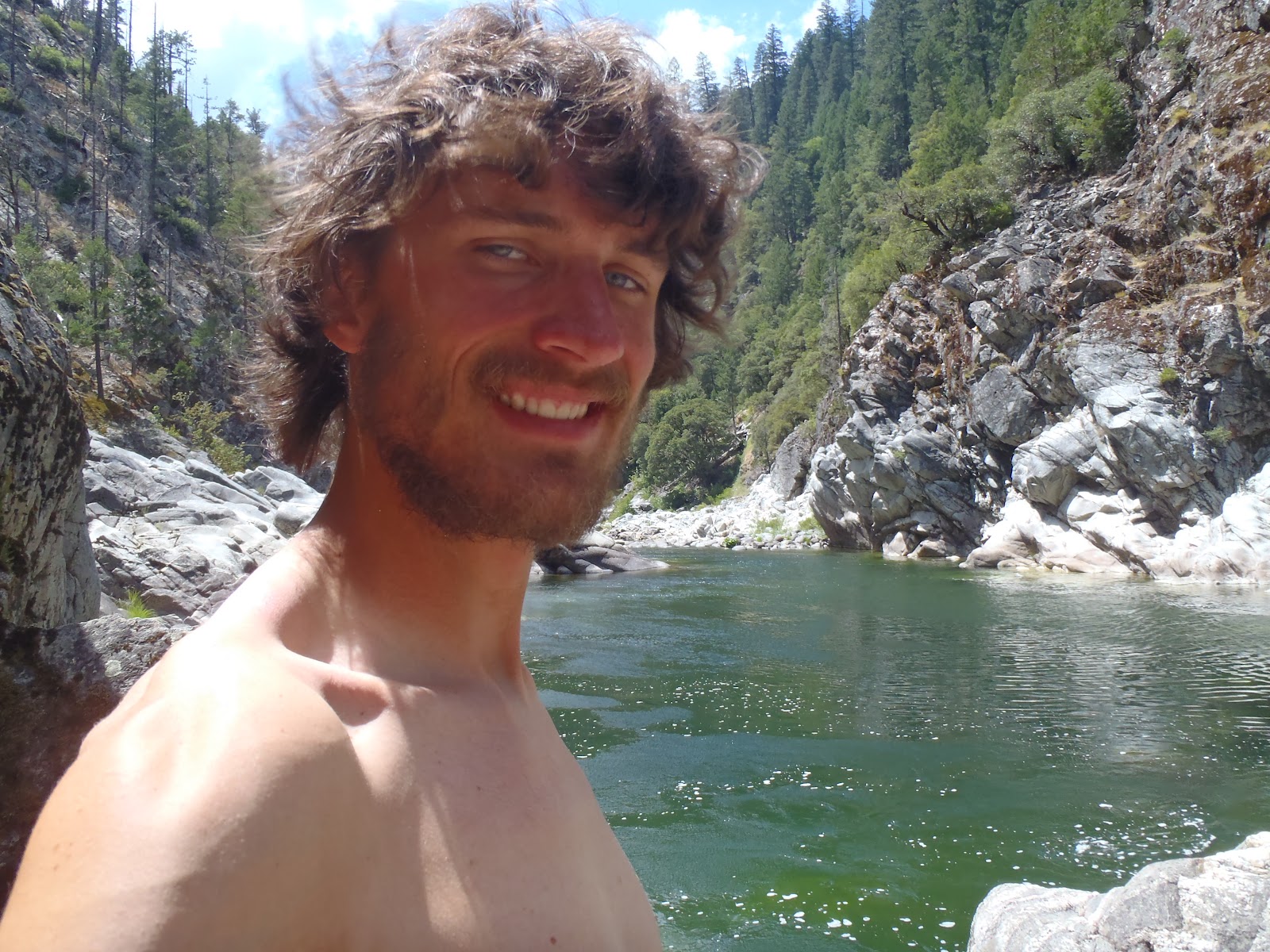
I think my favorite swimming hole on the whole trail tying very closely with Deep Creek was the Middle Fork of the Feather River. The trail crossed at this beautiful arch bridge and down below were giant boulders with neat pot holes carved into them, cool water rushing down a small waterfall, then a massive swimming hole deep enough for me to dive into. After jumping in a few times and swimming around some of the large boulders, I sat on the rocks to sun-dry and cook my lunch. As I waited, there I soon began to hear the whirl of a helicopter. I looked up and saw one flying overhead fairly close by carrying some object by a cord. Pretty soon after another came by and this time I could make out the water spraying out of the container the helicopter was towing. Then not too long after another one came by really low and you could see it quite detailed. It went just around the bend then dropped really low down so I could just see the blades over the tree tops. After hovering for a bit it lifted up with a full bucket of water you could see pouring off. By now, I had realized there must be a forest fire nearby that they are trying to contain. However, I kept scanning the mountains nearby and didn't see any smoke on the horizon so figured it must be safe and this was just the closest water. Only the next day did I realize it was much closer than I thought and was actually just about 8 miles up trail! I came across this strange orange powder on the trees then saw a firehose and a burned out campsite where the fire was contained to just a few hundred square feet. I later learned from some rangers coming in that they still didn't know who started the this. The powder is a fire retardant which they really didn't need to use in this case but had loaded up one of the helicopters and once it is up in the air they just need to dump it somewhere. I was thinking I'd hate to be a hiker caught in a shower of some strange Agent Orange looking chemical mist descending on you. Regardless, I was very glad it was so well contained and cool to see the fire choppers in action.

My other swimming hole of note was at Rock Creek soon after passing the beautiful Burney Falls. This spot was gorgeous with a 25 ft falls down into an upper pool carved into a cliffside, then another smaller falls down into a larger lower pool that got about 5 ft deep. It looked like some beautiful hidden swimming spot I'd seen in a movie. The only problem was that I had to climb down a cliff essentially to get to it. I was so excited to get down so I took the first route I saw which wasn't the greatest plan. I grabbed my socks (to clean), some trail mix and my water filter fill my hands as well. I soon realized how much of a challenge this was going to be, and as I continued to inch my way down the loose gravel, I suddenly slipped and began to slide down the side. I quickly grabbed whatever I could find to keep me from falling to my death. My trail mix had been strewn across the cliffside (which made me sad because it was my favorite kind), and I had to gather the socks I dropped. Just when I regained my nerves, I realized going back up may now be just as hard with all that loose gravel so I continued down hugging the wall. I went and grabbed for a rock about the size of a basketball sticking out to help me down when suddenly it gave out and fell just inches from crushing my foot then tumbled down into the pools below taking a spray of rocks with it. That also really freaked me out, but it seems there was only one way out which was down. I hugged the cliff down to the upper pool being very careful to test all my hand and foot holds. Once there, I enjoyed the view for a bit then had to essentially do a trust fall over the lower waterfall so I could reach the mossy cliff on the other side with my my hands to gain more stability and take a big step over the rushing water onto the moss-covered slippery rock on the other side. After successfully getting over that, it wasn't too much more work to get down to the lower pool. I sat down and could still feel the adrenaline coursing though my veins. I caught my breath then went to enjoy the spoils of my idiocy by getting into that wonderful pool. It felt like paradise especially since I hadn't been able to douse myself since the 30 mile dry stretch on the Hat Creek Rim. After enjoying the view for a while and drying out, I took a different route up the other side which was a bit better but still dangerous with loose gravel all around. In the end, I probably would do it again but would be much more cautious in planning a route down. Boy was that water and view worth it though!
High: Spectacular Side Trips (mile 1369, 1353, 1380, 1423)
The PCT is a great trail that takes you by some amazing sights but simply can't directly pass by everything. When I have my 20 mile quota to get in, it can often be hard to justify taking longer side trips so I always want to make sure it is worth it, and in this past stretch, I have found that it has certainly been the case. Normally I won't consider going farther than half a mile off the PCT to see a sight or grab water (even if is just 0.2 miles, I still have to give it a second thought). Only big stops that I have planned like Mt Whitney would let me travel farther than a mile out of my way. Luckily for me these last four stops were all within 0.5 miles and were such a great sight.The first was the Terminal Geyser in Lassen Volcanic National Park. I wasn't sure what to expect in Lassen but in some ways I would say it is similar to Yellowstone with all the volcanic activity centered around the beautiful Mt. Lassen. At first, I doubted this little trip because it took be far downhill, but then I turned into the geyser and wow what a view. There was a stream of very hot water flowing down from the geyser and you could see all the steam billowing off of it. It never erupted, but is was so cool just watching the steam pour out and all the beautiful colors in the rocks around the geyser. The best thing was it was in the backcountry which meant no flocks of tourists, and I had it all to myself getting as close as I wanted (but even I had my limits and knew it really wasn't safe to get too close if I didn't want boiling water to shoot into my face).


Next and not to far away was the amazing Drakesbad Ranch; a resort in the middle of a field of hot springs that was super hiker friendly and allowed me to come in, shower and enjoy their facilities free of charge. I could even buy lunch and get a great buffet of sandwiches. The best of all was their hot springs fed pool. It was like a normal pool but the temperature was always 98 degrees, and I could see where the water came in and flowed out. I just floated in there all afternoon long and it felt like a giant bath, simply paradise.
After that I headed up past Old Station and just before the long waterless stretch on the Hat Creek Rim, I got to tour the Subway Caves. We saw the entrance to a smaller cave just before on the trail that looked more like a sink hole but this one was huge. It was big enough for me to stand in the whole way through and seemed almost half a mile long. It had these big chambers in it as well and what they called lavacicles hanging from the celing since it was formed from the old lava tubes. The best was the cool temps down there, and I even busted out my jacket for the cave. I also forgot how dark caves can get and without my headlamp couldn't see my hand in front of my face.
Finally, one of my favorite spots on the trail so far, Burney Falls. One of the guides wrote that Theodore Roosevelt had called it the 8th wonder of the world which at first I laughed at but after getting there I can almost see his point. The falls was big but clearly not the biggest and had two large flows of water coming off. The best though was the wall of cascades all around it where water just seemed to flow out of the cliffside from all over creating a truly beautiful scene. I couldn't imagine coming across this site before all the facilities of the nearby state park were put in because it looked almost sacred. I could feel the cool mist pouring off the falls as well and the water was so frigid I didn't dare swim. The other great thing about the park was the store serving soft serve ice cream but even in my thru-hiker hunger I'd say it was more worth coming off trail for the falls that for the treats.
High: Conquoring the Hat Creek Rim (mile 1,382 to 1412)
This is another one of these sections I am very proud to label as a high because it had much potential to be a low. I had heard all the horror stories about this hot dry 30 mile stretch without any water on trail up in northern California and was both dreading it and preparing for it the whole time I passed through Lassen National Park. I hiked this stretch with a fellow Ohioan I met who started in the Sierras and got off in Dunsmuir named Halfmile. We cameled up at the drinking fountain at Subway Caves then headed out in the cooler evening temps up the Hat Creek Rim. The Rim is a roughly 250 ft mesa-like formation that has a large cliff stretching for miles and overlooks all the mountains to the west and the Hat Creek where lava flows had covered the ground millions of years ago. There was not too much shade up there with brushy shrubs and was quite reminiscent of Southern California. When we reached the top (again the climb wasn't the battle mostly just the fact that we had to carry so much extra water) we had an amazing view of the sunset and saw Mt Lassen to the south and Mt Shasta to the north. Then we continued on to do some night hiking. We reached a field of cows who weren't too happy to have visitors, and their green eyes glared back at us as we gazed at them with our head lamps. The ground was rocky and hard to navigate at night but when we finally stopped we had one of the best nights for star gazing in the wide open field. I saw the Milky Way, many shooting stars, and even picked out a few constellations from this star map I printed off earlier.The next morning we tried to beat the sun leaving early and it was a nice cool temperature for a while. We continued to have great view out in the sunrise and soon reach a water cache that some trail angels had made of sticks that looked like a giant nest. I didn't even need any of the water and saved it for other hikers since I was still pretty full. By lunch time we had made it off the rim and descended onto some awesome black lava rocks below where you could almost imagine the flows they came from. We had lunch with a fellow hiker Hamburger from Germany who told us all his stories about travelling around the Americas. Then best of all just as we were about to get to the water source we passed a road where other trail angels had left a cooler of ice with Shasta pop. I had never made the connection of the pop Shasta with the mountain but it was so cool and refreshing I think I will always remember that moment when I drink Shasta from now on. In the end, we made it to the next creek with water to spare and I wasn't even thirsty. I think I'm starting to get the hang of thru-hiking.
Wow Matt, looks like your having the trip of a lifetime, even though it doesn't involve a mountain bike, I am kind of envious...
ReplyDelete